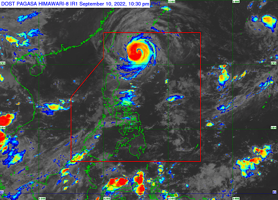
Manila, Sept. 10 — The Philippine Atmospheric, Geophysical and Astronomical Services Administration (PAGASA) said typhoon Inday (international name: Muifa) continued to intensify as it moved north-northwestward over the Philippine Sea on Saturday evening, Sept. 10.
In its 11 p.m. bulletin, PAGASA said Inday had maximum sustained winds of 140 kilometers per hour (kph) near the center and gustiness of up to 170 kph.
It was located 380 kilometers east-northeast of Itbayat, Batanes and was moving north-northwest at 15 kph.
PAGASA said typhoon Inday remains less likely to have a direct effect on the country throughout the forecast period, but its trough or extension and the enhanced southwest monsoon or “habagat” may bring rains over extreme Northern Luzon and the western sections of Central and Southern Luzon.
“The latest forecast scenario for Inday shows that while the hoisting of tropical cyclone wind signals remains less likely at this time, further westward shift in the track forecast and/or expansion in the extent of tropical cyclone winds may result in the hoisting of wind signals over portions of extreme Northern Luzon,” PAGASA said.
“In the next 24 hours, Inday may bring moderate to rough seas over the eastern seaboard of Northern Luzon. These conditions may be risky for those using small seacrafts. Mariners are advised to take precautionary measures when venturing out to sea and, if possible, avoid navigating these conditions,” it added.
Based on the latest track forecast, Inday will likely leave the country’s area of responsibility by Tuesday, Sept. 13.For any query with respect to this article or any other content requirement, please contact Editor at [email protected] Bulletin
Inday further weakened but may bring gusty winds, rough seas over northern Luzon

